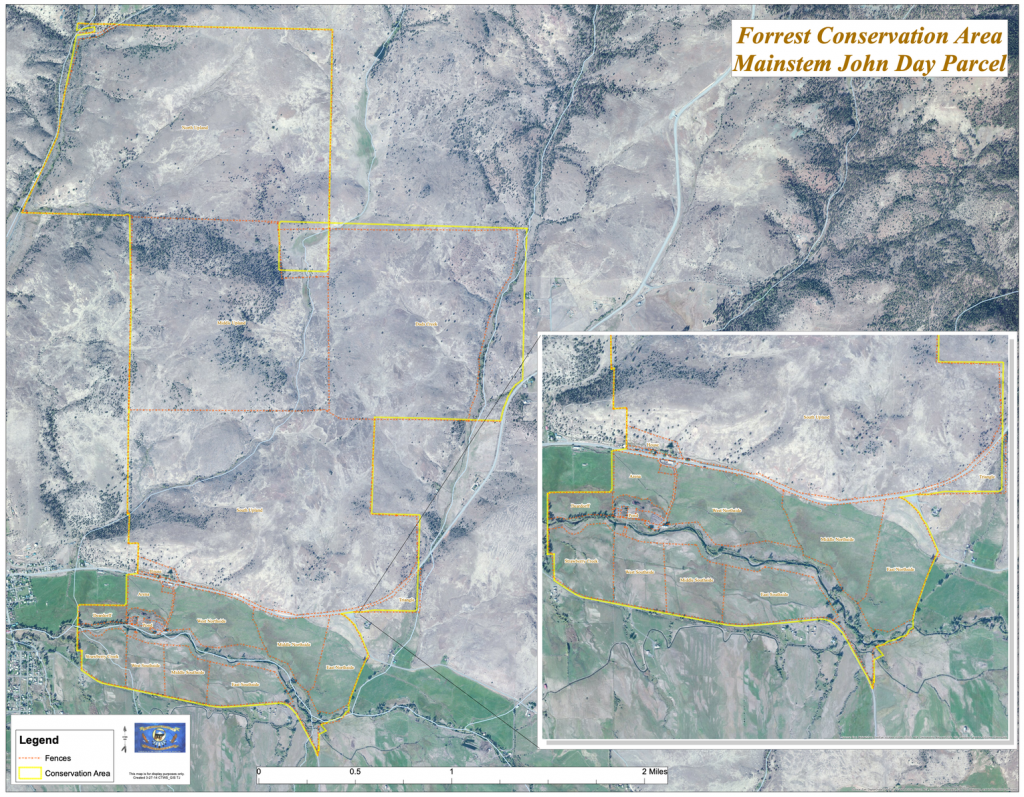
The Forrest Ranch property was acquired by the Confederated Tribes of Warm Springs in 2002. The acquisition is comprised of two parcels: the parcel on the upper mainstem John Day River, known as the “Mainstem Forrest Conservation Area” and the parcel on the Middle Fork John Day River, known as the “Middle Fork Forrest Conservation Area”. The former is 3,445 acres and found a mile east of Prairie City. The latter parcel is 786 acres along four miles of the Middle Fork John Day River, just below Bates, Oregon.
Forrest
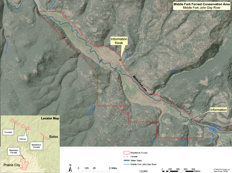
The Middle Fork Forrest
The Middle Fork Forrest offers scenic hikes along the Middle Fork John Day River, as it is just down river from Bates State Park. This property has been averaging about 30% of the river’s spring Chinook spawning. It is a popular place to watch these fish in September. Fishing is not allowed. Restoration projects are ongoing at Middle Fork Forrest, with a very large re-route of the river between Vinegar and Vincent Creeks planned in the next few years. There is a small grazing program at this parcel during the summer months. The access permit station is located at Vincent Creek gates near the corrals.
The Middle Fork Forrest parcel is accessed by Middle Fork Lane (county road 20) access points, primarily at Vincent Creek. The property is surrounded by Malheur National Forest, with Bates State Park bordering its eastern edge.
The Mainstem Forrest
The Mainstem Forrest continues ranching activities with a conservation grazing program to demonstrate that fish habitat recovery and agriculture are a possibility together. The property offers the McHaley Pond picnic area for visitors. The pond is seasonally stocked with trout for free-fishing day events and day fishing. Fishing is not allowed on the river. The property has ample hiking opportunities and is popular for deer and elk hunting by permission in the fall. The Mainstem Property is the location of the Upper John Day Conservation Lands Program office and staff. There is a kiosk to fill out access permits at the office area (about 1 mile east of Prairie City, with access to McHaley Pond), with public access points at Dads Creek gate on Highway 26, and at the quarry gate on Dixie Creek road.